- DE |
- EN
Intensive administrative cooperation for effective disaster prevention
Overview
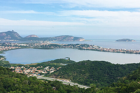
Niteroi is a Brazilian coastal city surrounded by hills just outside Rio de Janeiro. With its approximately 500,000 inhabitants, Niteroi’s economy focuses mainly on commerce and services. In 2010, the city had the highest Human Development Index in the state of Rio de Janeiro and the seventh largest among Brazilian municipalities. Also, it is the first of the state concerning sanitation performance.
As a coastal city, Niteroi has at the same time, many tourism possibilities with extraordinary beaches, but also, problems related to sea level rising and eventual rough seas. Climate change has also contributed to an increase in droughts and wildfires.
The city is located between the sea and the hills and in the past decades, with the increasing of the city combined with a non-structured urbanistic plan, most of the hillsides were irregularly occupied by low-income families in a massive way. As the result of this situation, Niteroi has areas occupied by vulnerable people where there are significant risks of land sliding.
In April 2010, more than 240 people died in landslides, most of which occurred on the hills surrounding the city. After that, many preventive actions were made, aiming to reduce the number of accidents and deaths, what generated excellent results.
Finally, the municipal government has developed a Resilience Plan aiming to strengthen the direct and indirect actions of the Niteroi Civil Defense. It has had a great importance and a strong impact in the city. The plan was finalized and launched in December 2019 and its implementation has already started.

Background
In April 2010, Niteroi had its worse disaster in the city’s history, with more than 240 deaths in landslides that occurred on a large part of the hills in the city area. The Favela Morro do Bumba was particularly hard hit.
In the summer of 2014, an atypical long drought period increased the occurrence of wildfires that affected around 629.5 hectares, the equivalent of 4.7 percent of the whole city area. Through this fact, the local government established a Program called Niterói Contra Queimadas (Niteroi against Wildfires), which has a series of actions related to prevention and addressing wildfires. This Program is still running and is being successful in reducing the occurrence of fires.
In 2018, the city developed a new risk mapping related to land sliding, classifying the city areas in 5 risk levels (very high, high, medium and light risk). This mapping showed the most vulnerable areas and gave the municipal government an updated scenario that allowed the development of an optimized Resilience Plan, which was launched in December, 2019.
The Niterói Resilience Plan follows the guidelines established by the United Nations Office for Disaster Risk Reduction (UNISDR) to guide public authorities to prepare for possible threats and to reduce conditions of vulnerability.
In line with the Hyogo (2005-2015) and Sendai (2015-2030) Frameworks for Action, the goals of the Plan for a “More Resilient Niterói” are guided by the ten essentials of the Making Cities Resilient Campaign, of which the municipality has been part since 2017. The Plan for a “More Resilient Niteroi” is part of the Niteroi Strategic Plan “the Niteroi We Want” which was developed in 2013 for the upcoming 20 years and involved about 10,000 persons who live or work in the city.
As Niteroi is a municipality with a very lush ecosystem, which has more than 50 percent of its territory composed by areas of environmental preservation, the Resilience Plan seeks in large measure to reduce harmful impacts on the environment. Thus, this plan has as one of its most important goals the conservation and restoration of ecosystems, the strengthening of natural barriers as effective contributors to the reduction of the impacts of extreme weather events due to climate change.
Objectives
The Niteroi Resilience Plan includes actions to inspect, review and maintain the city's infrastructure, covering the points most likely to be at risk, in addition to strengthening a mobilization network to share information on vulnerabilities and points of attention. It also includes high level technologies, as Meteorological Stations and Pluviometers System with real time data transmission and a high power remote control sirens alert system, with redundancy transmission system via internet and radio (integrated system that makes it possible to talk to residents and carry out check tests with pre-scheduled diagnostics). This technology guarantees the ability to forecast crisis situations and monitor areas of risk, as well as actions to strengthen institutional capacity for resilience.
Therefore, the City of Niteroi reinforces its internal capacity to articulate ongoing actions with new initiatives that focus on areas vulnerable to disasters. The cooperation and integration between different sectors of government and civil society in the measures listed below seeks to make risk prevention and damage mitigation even more solid and efficient.

Activities
Activities – As from December 2018, Resilience Plan launching
- INSTITUTIONAL STRENGTHENING OF CIVIL DEFENSE
- Expand the Civil Defense Secretariat to the Geotechnical area, hiring new multidisciplinary professionals, taking on the new cooperation activity between the two departments.
- RISK MANAGEMENT
- Slope stabilization measures at all high / very high priority points – 57 actions in one year – extending later the actions to medium risk priority points.
- Extend the siren system with appropriate community training
- Reforestation on slopes - 30.000 trees in two years
- Purchase of weather radar
- INSPECTION AND BANNING
- Intensify banning buildings on protected areas
- Carry out building demolitions in risk areas – 300 actions in two years
- HOUSING QUALITY
- Build Social Properties – 2000 units – from 2017 to 2020
- Implement a Social Architect Program – this program promotes housing improvement, since housing precariousness may cause health problems and compromises the safety of the family. These are renovation projects, economically and environmentally friendly, using local labor, prioritizing the use of material available in the community and resources often from Housing Funds or Community Banks.
- MUNICIPAL POLICY FOR RESILIENCE AND CIVIL SOCIETY PARTICIPATION
- Define the Municipal Policy of Protection and Civil Defense
- Establish the Municipal Council for Civil Defense and Protection
- Reach 100 Civil Defense Community Groups skilled as from December 2018 to December 2020 – goal was already reached.
- Insert Civil Defense Knowledge as a discipline in the school curriculum
- Develop risk prevention and volunteering mobile apps
- Celebrate a cooperation agreement with the military fire department
Effects
The Civil Defense Community Groups, which will reach more than 100 units in 2020, have a fundamental role in risk monitoring of the territories and also making necessary actions faster and effective, in emergency situations, as broadcast DC information to other residents, orientation on evacuation and driving to support points, conducting DC agents within the community, first response in case of land sliding, isolation of area and first aid procedures.
In addition, it brings to the communities a prevention culture and promote partnership with the public service.
The interventions indicated on this plan were determined based on recent risk mapping contracted by the municipality. Priority was given to locations with high / very high-risk classification and currently, other works are being planned for medium risk locations. The interventions are a result of the mapping which additionally provided recommendations and basic project for each high / very high-risk area in the municipality. Thus, it was possible to carry out a ranking of priorities based on the number of people impacted at each listed point and also, as from the cost of each measure. This methodology facilitated the indication of priorities and also streamlined bids for the different interventions.
Finally, the need for demolition of properties in areas at risk, the construction of social properties and support for the adaptation of houses with insalubrity problems make up a set of actions related to housing, aiming to improve safety and the quality of life of the population.

Conclusions
All the planned actions comprise a set of initiatives that, both in an isolated and integrated manner, will promote improvements in all components of the Civil Defense work: prevention, preparation, response and reconstruction.
The strengthening of the Secretariat for Civil Defense and Geotechnics with professionals from different sectoral areas promotes a much greater response capacity to planning, operating and acting in prevention or emergencies, which combined with measures related to the use of technologies, reforestation and more intense participation of community groups of volunteers through the understanding of risk perception and procedures for crisis situations, makes a significant reduction in incidents in the municipality.
further information
Published: 27/07/2020
Contact
Mr. Walace Medeiros
Municipal Secretary of Civil Defense and Geotechnics
City of Niteroí, Brazil
Telephone: + 55 21 2717-2631
Mobile: + 55 21 98891.5557
Images


Categories:
Good Urban Governance
crisis management and disaster preparedness
Integrated urban development
Participation and urban planning
Cities and climate change