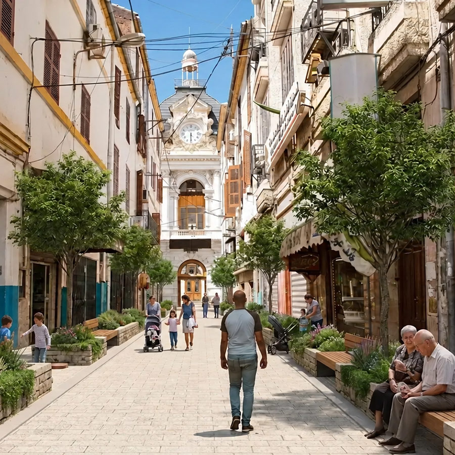
Connective Cities, in cooperation with GIZ projects in the region, will bring together representatives from Constantine (Algeria), Hebron and Gaza (Palestine), drawing on experiences from other cities in the MENA region.
The workshop will focus on accessibility and inclusion in urban development. How can cities ensure that streets, parks and green public spaces are safe, welcoming and usable for everyone – including children, older people and people with different mobility needs?
Through peer exchange and AI-supported visualisations, participating cities will explore practical solutions for greener, more inclusive and climate-resilient urban spaces.
The exchange forms part of the ongoing Green Corridors learning process, fostering municipal cooperation and knowledge sharing across the region.
As Bhutan’s towns and municipalities continue to grow, they face the challenge of accommodating urban development while preserving the country’s strong environmental legacy. Urban heat, flooding, habitat loss and changing relationships between people and nature are making new approaches to urban development increasingly important.
In this virtual Connective Cities Insight Session, the Bhutan Ecological Society (BES) will share how Nature-based Solutions and eco-regenerative development can help create greener, healthier and more climate-resilient urban areas.
Drawing on practical and emerging initiatives from across Bhutan, the session will explore how biodiversity conservation, ecological restoration, green-blue infrastructure, recreation and community development can be integrated into urban development.
A particular focus will be the planned Eco-Regenerative Park at Rinchending, Phuentsholing, where biodiversity conservation, green space, nature interpretation, sustainable recreation, wellness, regenerative tourism and benefits for local communities are being brought together. Further examples from Samdrup Jongkhar and the Gelephu Mindfulness City landscape will illustrate how ecological restoration and nature-based experiences can contribute to more resilient and liveable urban areas.
The session will feature
Nawang Norbu, Executive Director, Bhutan Ecological Society Setting the Scene: Nature, Climate Resilience and Bhutan’s Urban Future
Namgay Dendup, Nature-based Solutions Specialist, Bhutan Ecological Society Bringing Nature Back into Bhutan’s Urban Future: Nature-Based Solutions in Practice
The presentations will be followed by an open discussion and exchange with participants, offering municipalities and practitioners from different regions an opportunity to reflect on Bhutan’s experiences and share how Nature-based Solutions are being translated into practical and locally appropriate urban interventions in their own contexts.
Date: Thursday, 22 October 2026 Time: 10:00–11:00 CEST Format: Online Language: English
Connective Cities brings together Egyptian municipalities and international experts to explore innovative approaches to greener, more resilient urban spaces.
On 28–29 September 2026, Connective Cities organised a two-day hybrid peer-learning workshop in cooperation with the Urban Development Fund (UDF) and GIZ Egypt. Representatives from Aswan, Port Said and Alexandria worked with international experts to develop practical solutions for urban greening and climate-resilient public spaces.
The workshop focused on a central question: How can cities transform existing streets and underused urban spaces into green corridors that improve urban liveability and strengthen climate resilience?
Three cities, three urban challenges
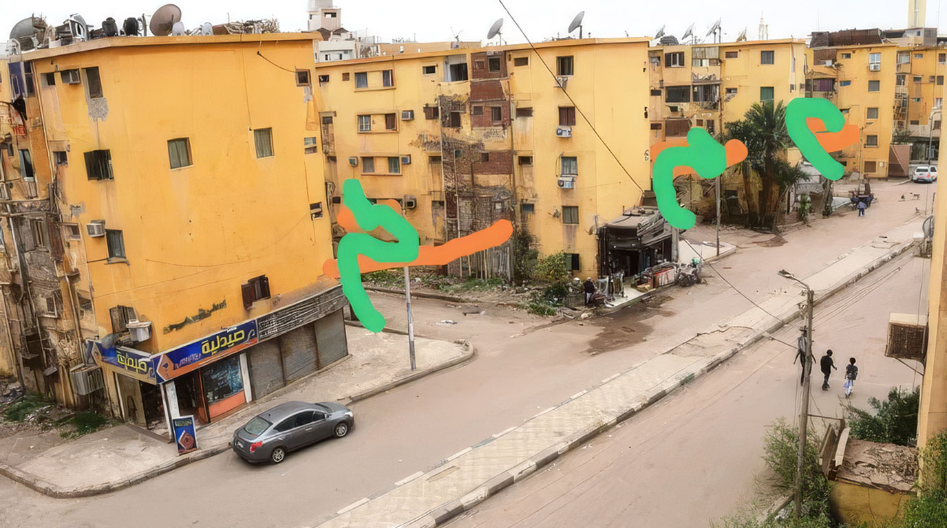
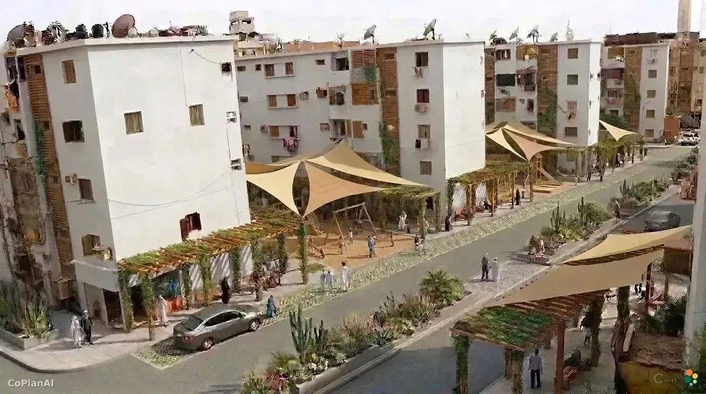
Aswan explored opportunities to introduce shade, greenery and pedestrian-friendly spaces in a residential area affected by high temperatures and limited vegetation.
Residential neighborhood as it currently stands. Green and orange brushstrokes indicate areas slated for redevelopment.An AI visualization for the redesign of the residential neighborhood. Advantages: Residents and children benefit from shaded, greener community and play areas. Disadvantages: Drivers must expect the street to be narrower and will only be able to drive through it slowly.
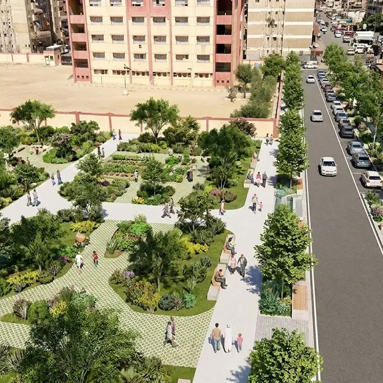
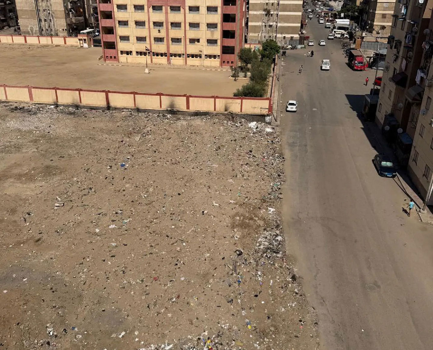
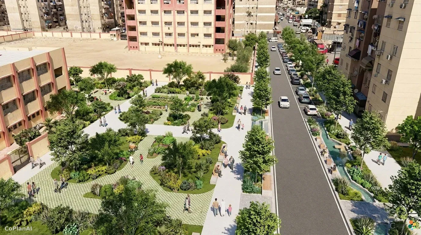
Port Said focused on greening public spaces despite saline soils, water scarcity and limited financial resources.
Unused open space in Port SaidAI visualization of the previously barren vacant lot as a city park. Advantages: Residents and pedestrians benefit from shade, recreational opportunities, and safer, step-free paths. Disadvantages: Drivers lose through traffic capacity and faster access.
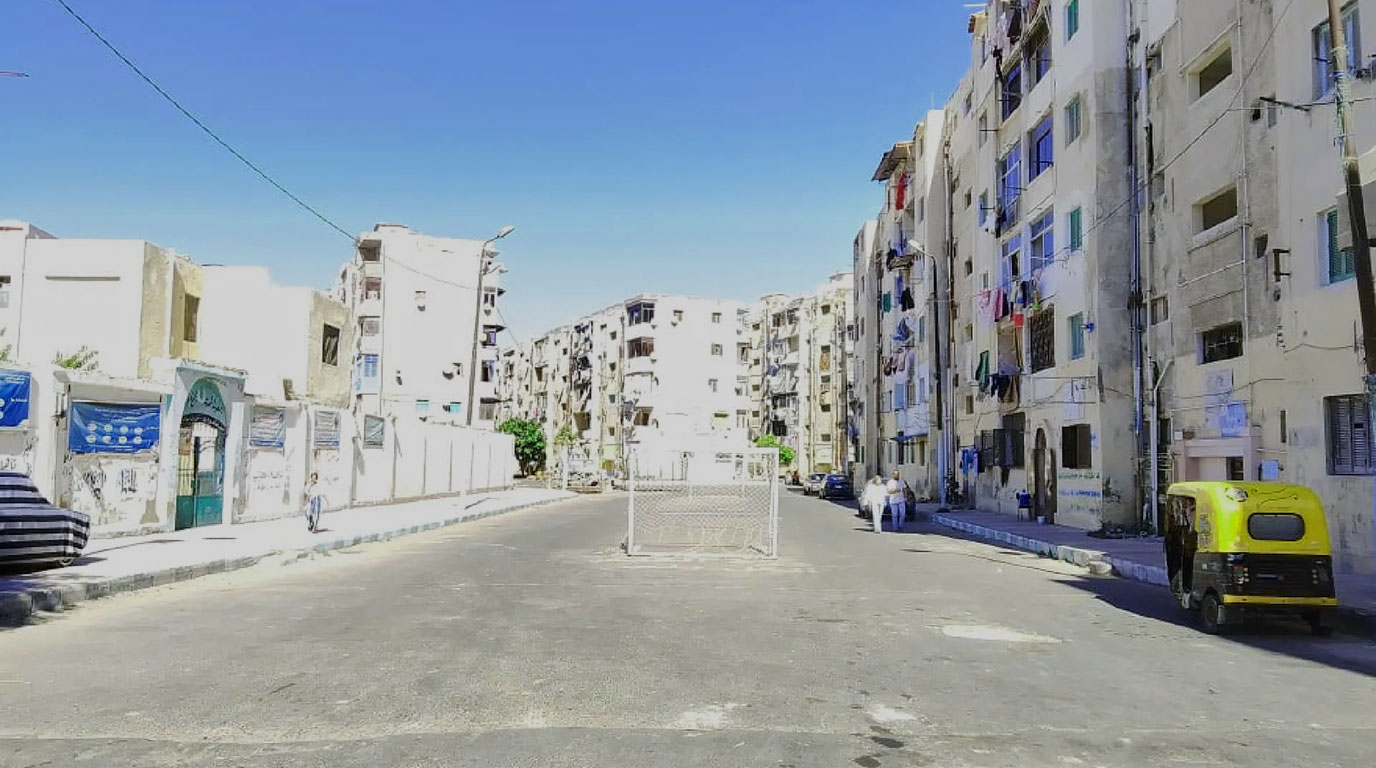
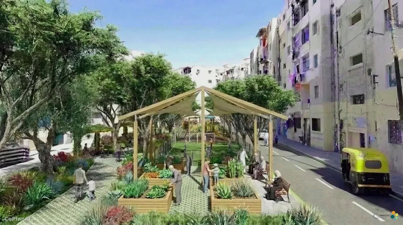
Alexandria examined ways to improve streetscapes and introduce appropriate vegetation while addressing poor soil conditions, water availability and maintenance challenges.
Sealed surfaces worsen the urban climate in Alexandria.AI visualisation of the previously empty street as a green communal space. Advantages: Local residents gain shaded seating areas, play areas and vegetable patches for growing food. Disadvantages: Local residents lose parking spaces and have fewer opportunities to drop off passengers quickly.
Through structured Peer Advice, municipal representatives and experts jointly identified feasible interventions adapted to local conditions. Proposed solutions ranged from shaded pedestrian routes and small green pockets to soil improvement, locally adapted tree species and partnerships with schools, communities and local organisations.
Combining peer learning with AI-supported visualisation
A distinctive feature of the workshop was the integration of AI-supported visualisations into the peer-learning process. Based on photographs of existing urban spaces, alternative future scenarios were developed to illustrate how proposed interventions could transform the selected sites.
These visualisations helped translate technical recommendations into tangible spatial concepts, supporting discussion, comparison and refinement of different options. Rather than presenting predetermined designs, the AI-generated images served as a collaborative tool, enabling participants to explore possibilities and assess their feasibility against local realities.
From ideas to action: Backcasting—back from the future
The workshop also introduced Backcasting, a planning approach that starts with a desired future and works backwards to identify the steps needed to achieve it. Building on the Peer Advice and AI-supported scenarios, participants explored how long-term visions for greener urban spaces could be translated into practical priorities, partnerships and implementation steps. The backcasting method thus enriched the planning activities.
The combination of Peer Advice, AI-supported visualisation and Backcasting demonstrated how digital tools and structured international exchange can complement one another, helping cities move from shared challenges towards locally adapted solutions.
International expertise and regional exchange
The learning process benefited from contributions by Prof. Dr. Heba Khalil and Stefan Scharfe, who shared international experiences and technical perspectives on sustainable urban development, green infrastructure and climate resilience.
The workshop was conceived and led by Jelena Karamatijevic (Connective Cities) and facilitated by Aida Tarhouni. It was organised in close cooperation with Dr Marwa Ahmed of the Urban Development Fund (UDF) and GIZ Egypt. Special thanks go to Dr Marwa Ahmed for her collaboration with the Egyptian partners and to colleagues from the Connective Cities project (CBUID) for their valuable support in preparing and delivering the workshop. Positive feedback from the participating institutions highlighted the value of combining municipal experience, international expertise and innovative digital approaches.
What’s next?
The workshop in Egypt forms part of the broader Connective Cities regional learning process on Green Corridors in the MENA region. Further exchanges with municipalities across the region will build on the results, promote cross-border knowledge sharing and support the development of practical approaches to climate-resilient urban development.
The experience from Egypt illustrates how peer learning can evolve: from exchanging ideas to jointly visualising solutions and identifying pathways towards implementation.
Further Information:
Jelena Karamatijevic | Advisor on Sustainable Urban Development
Connective Cities · GIZ | jelena.karamatijevic@giz.de
International Community of Practice for Sustainable Municipal Development
NEWSLETTER – ISSUE NO. 98, September 2026
Dear Readers,
“It’s the economy, stupid!” is a somewhat blunt and much-quoted statement by James Carville, which he himself now regrets having made in such a simplified form. This statement can be expanded to cover many aspects of sustainability, for example: “It’s nature and the economy, stupid!”.
Climate-resilient and liveable communities attract investment, and a thriving economy creates the financial scope for climate adaptation measures. In this issue of our newsletter, we explore the interplay between the local economy and nature through concrete examples and discussions with experts.
We take a look at how the Bukamoso Business Centre in Windhoek, Namibia, has evolved from a business incubator into a local hub for young people to start their own businesses.
We also demonstrate how local authorities are developing and implementing innovative solutions to strengthen their climate resilience as part of the ‘Nature at the Heart of Municipal Resilience’ learning process.
Also, we would like to cordially invite you to our upcoming “Deep Dive”, where for the next one and a half years, we will be looking at how the economies of municipalities can be strengthened to be globally competitive. Through this extended learning process, municipalities around the world will be put together to pilot concrete project ideas.
We will keep you updated on how our colleagues in the MENA region, particularly in Egypt, are making their local communities more resilient and liveable by creating green corridors. We would also like to invite you to take part in our Inside Session, ‘Bringing Nature Back into Bhutan’s Urban Future’, which explores Bhutan’s innovative approach to combining biodiversity conservation, climate resilience, well-being, and sustainable tourism.
If you are able to attend the German-Ukrainian Municipal Partnership Conference, we would be delighted to welcome you to our panel discussion, ‘When Facts Come Under Pressure: Strengthening Municipalities Against Disinformation’.
We wish you an inspiring read.
Your Connective Cities Team
INSIGHTS
The Bokamoso Entrepreneurial Centre in Windhoek
A Hub for Entrepreuners, Local Economic Development and Community Empowerment
The Bokamoso Entrepreneurial Centre supports small and medium-sized enterprises, particularly start-ups founded by young people. Over the past 16 years, it has supported an estimated 1,200 young people aged 18–35 in their entrepreneurial activities. Originally functioning as a business incubator, it provided SMEs with basic infrastructure. It then added training, business development support and other capacity-building measures to promote sustainable business growth. The centre is currently exploring its future strategic direction and undergoing an organisational development process, which is being supported by its twin city in Germany, Bremen.
Nature at the Heart of Municipal Resilience: Paving the Way Forward
From urban parks and street trees to mangrove restoration and nature-based enterprises
The Connective Cities learning process “Nature at the Heart of Municipal Resilience” continues to bring municipalities from across Sub-Saharan Africa together to exchange experiences and develop locally adapted solutions. Following previous exchanges, participating municipalities are now refining their reform measures through online sessions and expert support, preparing them for the next stage of the learning process. The next milestone will bring participants together in Kigali, where municipalities will share their progress and further develop their measures towards implementation.
Call for Participation: Strengthening Local Economies – Globally Competitive, Profitable and Fit for the Future
How can municipalities strengthen their local economies in times of global uncertainty, structural change and rapid technological transformation?
Rising energy costs, changing supply chains, climate impacts and new technologies are reshaping local economies worldwide. At the same time, new markets, innovative technologies and new forms of cooperation offer municipalities significant opportunities to strengthen their economic base, attract investment and create new prospects for businesses and employment. Connective Cities invites municipalities and other local economic development actors to join the new international Deep Dive. Over approximately 1.5 years, participating municipalities will exchange experiences internationally, analyse their local economic structures, challenges and opportunities, and develop concrete strategies, partnerships and local projects for more resilient, innovative and future-oriented local economies. Join in!
The deadline for submitting expressions of interest is 31 October 2026.
Green Corridors Learning Process: From Exchange to Implementation
How can municipalities translate the concept of green corridors into practical and locally adapted solutions?
Green corridors can help to mitigate heat, improve the urban climate and biodiversity, and optimise rainwater management. Furthermore, they can reduce traffic and noise pollution. At the same time, they create attractive walking and cycling routes between neighbourhoods, public spaces and key everyday destinations. In this way, they promote sustainable mobility, accessibility and quality of life. In this way, green corridors combine climate resilience and environmental sustainability with healthier, better-connected and more liveable communities. On 28 and 29 September, the focus will be on local authorities in Egypt, who will meet in person in Cairo, while their peers and experts from the region will participate online.
When Facts Come Under Pressure: Strengthening Municipalities Against Disinformation
How can municipalities effectively counter disinformation, build trust and communicate reliably, even in times of crisis?
Disinformation and polarising narratives are posing increasing challenges for municipalities. False information can undermine trust in local institutions, intensify social tensions and spread rapidly, particularly in times of crisis. It is therefore all the more important for municipalities to be prepared and able to communicate quickly, credibly and effectively.
These questions will be the focus of the Connective Cities expert forum on 8 October 2026, from 2.00 to 4.30 pm in Berlin, as part of the 8th German-Ukrainian Municipal Partnership Conference. Come and join the discussion!
Insight Session: Bringing Nature Back into Bhutan’s Urban Future
How can municipalities grow while not only protecting nature, but actively helping to regenerate it?
In this virtual Insight Session, the Bhutan Ecological Society (BES) will demonstrate how nature-based solutions and eco-regenerative development can create greener, healthier, more climate-resilient urban spaces. The event will showcase concrete, innovative approaches from Bhutan and demonstrate how biodiversity conservation, ecological restoration, green-blue infrastructure, recreation and local development can be integrated into urban planning. Particular focus will be placed on the planned Eco-Regenerative Park in Rinchending, Phuentsholing. The park aims to combine biodiversity conservation, green spaces, nature education, sustainable recreational activities, wellness, regenerative tourism, and benefits for the local population. The event will take place on 22 October 2026 from 10:00 to 11:00 (CEST). Be inspired!
Engagement Global gGmbH
Service Agency Communities in One World
Friedrich-Ebert-Allee 40, 53113 Bonn | Deutschland
Contact: Sibylle Loyeau
Email: sibylle.loyeau@engagement-global.de
Deutsche Gesellschaft für Internationale Zusammenarbeit (GIZ) GmbH
Friedrich-Ebert-Allee 32 + 36, 53113 Bonn | Deutschland
Contact: Ricarda Meissner
Email: ricarda.meissner@giz.de
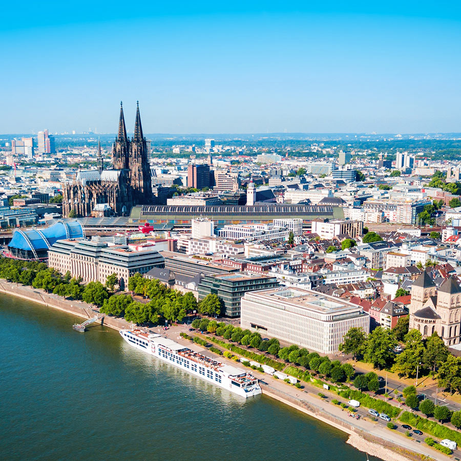
From 14 to 16 September 2026, the 19th Federal Congress on National Urban Development Policy will take place in Cologne. The theme is “Act together, act faster, think further: shaping cities for everyone”. This event will bring together stakeholders from local governments, politics, public administration, academia and civil society to discuss innovative approaches to sustainable, resilient and forward-looking urban development.
For the first time this year, Connective Cities will have a stand at the event run by the Service Agency Communities in One World (SKEW). The congress offers an excellent opportunity to raise the profile of the international city network and its services for facilitating professional exchanges between local authorities. We will be focusing on discussions with local authority experts from the fields of urban development, mobility, climate adaptation and sustainable transformation.
At the SKEW stand, we particularly want to show experts what Connective Cities has to offer and discuss potential opportunities for participation and cooperation. We will also present selected examples of good practice from the relevant specialist areas, as well as the Connective Cities Media Centre as a knowledge platform. We warmly invite network members attending the Federal Congress to take this opportunity to speak to the team at the stand. We look forward to exchanging ideas, making new contacts, and generating new impetus for municipal development cooperation.
Heat affects us all. It is one of the world’s fastest-growing and deadliest climate risks.
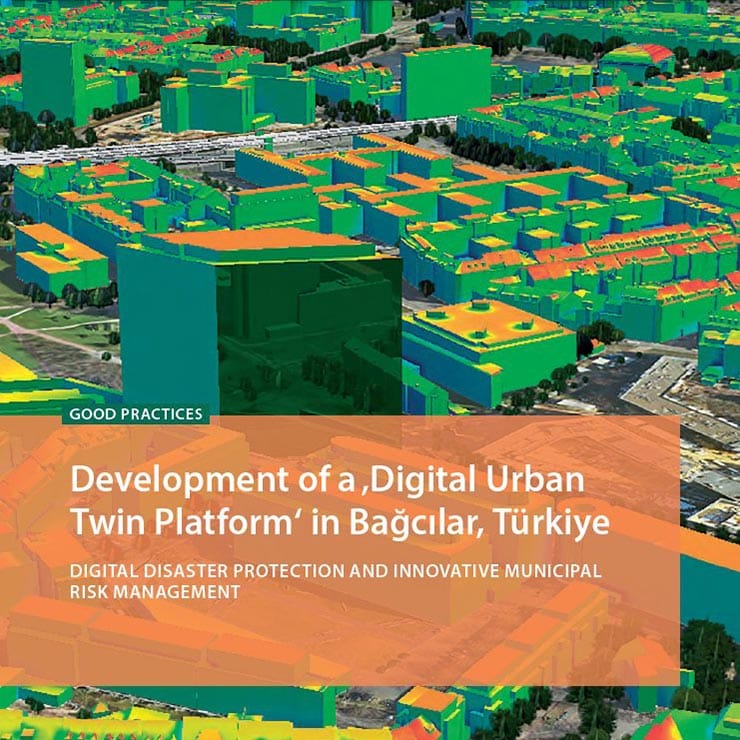
However, we are not powerless against it. Municipalities around the world are developing and sharing comprehensive strategies. These range from heat action plans and green and blue infrastructure planning to smart rainwater management, the use of AI, and the creation of digital twins for risk-informed crisis management.
Naturally, municipalities have also been tackling this crucial topic within the Connective Cities framework. We’ve put together a selection of examples from the Connective Cities context along with additional resources for you.
Heat in the City – The Connective Cities Deep Dive Learning Process From 2023-2025, six municipalities joined forces to analyse the impact of heatwaves and heat islands, and developed solutions tailored to local conditions.
Detailed interim report: https://www.connective-cities.net/en/media-center/heat-in-the-city-2/
Cities Leading by Example
This guidebook on risk-informed planning and heat mitigation, developed by the Connective Cities’ Deep Dive, serves as a practical guide for municipal actors, urban planners, policymakers and community leaders who wish to adopt a risk-informed approach and integrate heat adaptation into their planning processes. https://www.connective-cities.net/wp-content/uploads/2025/10/cities-leading_guidebook.pdf
Ibero-American Urban Climate Atlas
This project covers 11 cities in Spain and South America. The research aims to analyse the local context of each city with regard to the impact of heat islands. The objective is to assess changes in temperature patterns and their territorial effects within cities.
Union of Ibero-American Capital Cities (UCCI) and ICLEI South America https://e-library.iclei.org/uploads/IBER_ATLAS_EN_2.pdf
Financing heat resilience How governments can finance heat resilience through risk-informed investments, innovative financing mechanisms, and resilient infrastructure.
United Nations Office for Disaster Risk Reduction (UNDRR), Centre for Disaster Protection, National Disaster Management Authority (India) https://www.undrr.org/publication/documents-and-publications/financing-heat-resilience
Heat Action Plans in Local Government Practice (in German)
Implementation of the recommendations for drawing up heat action plans in local government practice (Plan°C)
German Institute for Urban Studies (Difu) https://repository.difu.de/items/c805c6fb-c3c1-4288-b1c9-eff356fb04bd
On July 8th, 2026, Connective Cities hold an online Insight Session to explore ways, by which urban forests can be cultivated under difficult climate conditions. Attempts to do so are notoriously difficult in dry regions with high temperatures and low precipitation, where the usage of scarce water resources has to be distributed between (urban) populations, local businesses, agriculture and industry. Planting and watering urban trees is regularly considered secondary under such circumstances, leading to unsuccessful attempts of urban afforestation due to a lack of financial support and maintenance work. The Insight Session was joined by 34 participants from 13 countries, representing a broad range of municipalities from Africa and the Middle East.
Over the past decades, the Miyawaki-method of planting tiny forests has become an outstanding success story around the globe. In this technique developed by Japanese botanist Akira Miyawaki, a small dense forest is made from native trees and plants. The specifically dense way of planting a miscellany of indigenous plants accelerate the growth of flora and fauna, so that after around five years, micro forests may already be entirely self-sustaining. The forests improve air quality, reduce heat and bring back lost biodiversity, thereby stabilizing ecosystems and countering the environmental degradation as a result of the climate crisis. A videographic overview of the Miyawaki-Method can be found here.
Stefan Scharfe, speaking on behalf of Miya-Forest, a forest-planting/educating/researching NGO based in Eberswalde, Germany explained the success of the Miyawaki method through the instance, that planting trees is usually broadly accepted among a range of actors such as urban populations, housing providers and local administrations. However, the participatory approach of planting urban micro forests must be facilitated through a small group of core actors who take ownership of the project. Especially a thorough soil study can significantly increase the chances of the micro forests to become self-sustainable after an initial, intense phase of watering and caring.
Coming from the highly urbanized and biodiversically degraded context of Amman, Jordan’s Capital, Deema Assaf from the ecological research studio TAYYŪN joined the Insight Session as a second speaker, providing the participants with valuable hands-on insights from the MENA region. Mrs. Assaf elaborated on the tedious work with paleobotanists to collect evidence of indigenous species from the region, proven evolutionary resilient towards the local climate conditions. The seeds of these plants known to the soil form the base for a multi-layered ecosystem featuring canopy, sub-canopy, shrubs and ground cover tiers. Over the course of its growth, the micro forest attracts insects, mushrooms and birds. Also edible plants may be included, turning micro forests into sites of (urban) gardening.
In result, the Insight Session provided the participants with new inspiration for their own project development within the scope of the currently running Connective Cities learning processes on ‘Nature at the Heart of Municipal Resilience’ and ‘Green Corridors in the City and its Surroundings’. The potential of the Miyawaki Method to produce fast and self-reinforcing benefits through various ecosystem services and according to the local circumstances makes urban micro forests a tangible and fitting intervention in the current situation of intensifying climate crisis. However, forestry-related preparation – i.e. soil data and seedlings –, as well as institutional backing, secured funding and maintenance of the planting project are key elements for micro forests to thrive.
Connective Cities provides the network for future engagement on the topic and looks forward to share expertise among urban practitioners
International Community of Practice for Sustainable Municipal Development
NEWSLETTER – ISSUE NO. 95, June 2026
Dear Readers,
Water is not only a driver of development; it is increasingly becoming a strategic resource. Falling groundwater levels, more frequent and prolonged heatwaves and droughts, as well as heavy rainfall events, are creating major challenges for municipalities around the world. At the same time, relatively modest investments in nature-based and technological solutions can help balance local water systems, protect lives, and prevent far more costly damage to urban infrastructure.
With this in mind, 16 practitioners from six countries have embarked on a two-year Deep Dive on Water Resilience, working together to develop and implement innovative, locally adapted solutions to their specific challenges. Following a three-day in-person meeting in Wuppertal, we take stock of the progress achieved so far.
Can AI-generated visualizations help make housing projects more transparent and accessible for all stakeholders, or do they risk oversimplifying complex planning realities? This question sparked an insightful discussion during a professional conference organized by Connective Cities and the German Association of Cities at the World Urban Forum 13 in Baku, Azerbaijan. In this issue, we look back at the key insights and debates that emerged from the event.
The Kenyan city of Kisumu offers a practical example of how public spaces can be made more livable: pedestrian-friendly, nature-based, and climate-conscious through the promotion of e-mobility. The initiative serves as an inspiring pilot project and a model for future urban space improvements.
We would also like to draw your attention to several upcoming events.
At the UCLG World Congress 2026 on 25 June in Tangier, Morocco, we will explore how municipalities can successfully translate strategies and development plans into concrete public services. Through practical examples, participants will discuss challenges and solutions related to implementing local sustainability and development strategies.
Sustainability will also be the focus of our next dialogue event, taking place from 20–22 October 2026 in Berlin. The event will examine the implementation of sustainability strategies in the context of major sporting events. Municipal practitioners, particularly those working in event management, sports, and Education for Sustainable Development (ESD), are warmly invited to participate.
We hope you enjoy this issue and find inspiration in the experiences and ideas shared within it. We look forward to welcoming you to our upcoming events.
Yours sincerely,
The Connective Cities Team
REVIEW
Connective Cities at the World Urban Forum 13 in Baku
AI-Powered Visualisation for Affordable Housing and the Upgrading of Informal Settlements
At the 13th World Urban Forum (WUF) in Baku, the German Association of Cities, in collaboration with Connective Cities, organised an interactive academy session on how AI-powered visual tools can help local urban planners discuss housing challenges, the upgrading of informal settlements and neighbourhood development in a more concrete and accessible way. On the one hand, the AI visualisations proved very useful for making decision-making transparent, particularly in dialogue with the public. At the same time, however, they also carry the risk of oversimplifying complex planning realities or suggesting solutions before key issues have been clarified. This tension gave rise to an insightful discussion, which could well continue beyond WUF13.
The Pedestrian-friendly Redevelopment of a Commercial District
Making Kisumu a better place to live: In the city centre, the three main roads – Oginga Odinga, Ang’awa Avenue and Jomo Kenyatta Avenue – form a triangle around a sports and park area. These roads are used by over 2,200 pedestrians every day. The redesign of the so-called ‘Walkable Triangle’ into a more pedestrian-friendly space has made it safer, more pleasant and more accessible, whilst preserving and integrating the existing tree population. Furthermore, the city is promoting e-mobility in public transport through the introduction of a battery-swapping system for motorbike taxis, known as ‘boda-bodas’, and three-wheeled taxis, known as ‘tuk-tuks’.
Water Resilience – Municipalities Prepare for Drought and Heavy Rainfall
Documentation of the Connective Cities Deep Dive event held from 5 to 7 May 2026 in Wuppertal
Examining their own challenges in water resilience, learning from experiences on other continents, and finding the courage to put innovative ideas into practice – these were the key elements of the first in-person meeting as part of the Connective Cities Deep Dive, held in Wuppertal from 5 to 7 May 2026.
In early 2026, a total of 16 experts from the German municipalities of Dresden, Wunstorf and Wuppertal, as well as from Akkaraipattu (Sri Lanka), Homa Bay (Kenya), Hyderabad (India), Natitingou (Benin) and Niš (Serbia), have started a two-year long working together to analyse innovative approaches and how they might be implemented. On this basis, they are developing and implementing locally adapted solutions to their respective challenges. The meeting in Wuppertal is a first interim step.
From Challenge to Practice – How Municipalities Turn Local Plans into Public Services
Local4Action Track – Lab as part of the UCLG World Congress 2026 in Tanger, Morocco
How do municipalities succeed in translating strategies and development plans into concrete public services? The Connective Cities Lab, organised in collaboration with the German Association of Cities, will address this question as part of the UCLG World Congress 2026. Municipalities worldwide face similar challenges when it comes to implementing local development plans. In the Lab, international municipalities will share concrete practical experiences: What obstacles had to be overcome? Which approaches have proven successful? And what can be applied to other contexts?
Call for Participation – Global Green Sports: Implementing Sustainability Strategies for Major Sports Events
Invitation for Municipal Experts to the Dialogue Event in Berlin, 20–22 October 2026
How can sustainability strategies for major sporting events be embedded in policy? How are these strategies implemented within city administrations and event management? How can the public be engaged and informed about sustainable development during major sporting events? Organised by Connective Cities in collaboration with the Education for Sustainable Development Unit and the Berlin Senate Department for the Interior and Sport (SIUS), the event invites cities from around the world to exchange experiences, showcase best practices and jointly develop innovative solutions for sustainable sporting events.
Engagement Global gGmbH
Service Agency Communities in One World
Friedrich-Ebert-Allee 40, 53113 Bonn | Deutschland
Contact: Sibylle Loyeau
Email: sibylle.loyeau@engagement-global.de
Deutsche Gesellschaft für Internationale Zusammenarbeit (GIZ) GmbH
Friedrich-Ebert-Allee 32 + 36, 53113 Bonn | Deutschland
Contact: Ricarda Meissner
Email: ricarda.meissner@giz.de
Water is becoming a key challenge for an growing number of local authorities worldwide. On the one hand, they are increasingly exposed to heatwaves and drought. But on the other hand, heavy rain and high water levels are leading to more frequent flooding. These risks come together to not only impact public health, but jeopradize private property and public infrastructure. Global water demand could significantly exceed available supplies by 2030. Water is thus becoming a strategic resource. It is therefore critical for municipalities to strengthen their water resilience.
Examining their own challenges regarding water resilience, learning from experiences on other continents and developing the courage to implement innovative ideas – all these were the ingredients of the first in-person meeting as part of the Connective Cities Deep Dive, held from 5 to 7 May 2026 in Wuppertal. The group had already met for a virtual kick-off in March 2026. In early 2026, a total of 16 experts from the German municipalities of Dresden, Wunstorf and Wuppertal, as well as from Akkaraipattu (Sri Lanka), Homa Bay (Kenya), Hyderabad (India), Natitingou (Benin) and Niš (Serbia) have started a two-year long working together to explore and analyse innovative approaches such as sponge city concepts, blue corridors and integrated blue-green-red infrastructure, and the possibilities for their implementation. On this basis, they develop and implement locally adapted solutions to address their specific challenges.
The report describes practical examples from Wuppertal and Leipzig, outlines the planned pilot projects of the six municipalities and summarises the key takeaways from the process so far.
At the 13th World Urban Forum in Baku, the German Association of Cities and Connective Cities hosted an interactive Academy Session on “AI-supported Visualisation for Affordable Housing and Informal Settlement Upgrading”. The session explored how AI-supported visual tools can help municipalities discuss challenges related to affordable housing, neighbourhood development and informal settlement upgrading in a more concrete and accessible way.
The session built on the work of the Connective Cities Working Group on Sustainable and Affordable Housing. It was deliberately designed not as a technology demonstration, but as a practice-oriented municipal learning format based on real municipal cases. The aim was to explore how visualisation can make complex planning questions more understandable and open new spaces for dialogue between municipalities, technical departments, decision-makers and local stakeholders.
The process started from real images provided from municipal contexts. With the support of CoPlan AI, these images were translated into possible development scenarios. The AI-generated visuals were not intended as final plans. Instead, they served as discussion inputs. They allowed participants to discuss housing quality, density, public space, greenery, climate adaptation, mobility, social infrastructure and possible implementation steps in a more tangible way.
A central added value of the format was the joint work around the images. The visualisations made abstract planning questions visible and enabled a creative, yet critical discussion: What future images are being created? Which assumptions lie behind them? Which opportunities and risks become visible? Which social, spatial, environmental, institutional and financial conditions would need to be assessed before an image can become a realistic planning step?
The session was moderated by Prof. Hilmar von Lojewski, German Association of Cities. Jelena Karamatijevic, Connective Cities / GIZ, provided the conceptual framing and introduced the Connective Cities perspective on municipal practice and peer learning. CoPlan AI, represented by Damiano Cerrone and Sampo Ruoppila, supported the participatory AI-based visualisation process.
Municipal case contributions and reflections came from Nairobi, Huye, Mariental, Hebron, Berlin and the Urban Development Fund in Egypt. Contributors included Godfrey Ngugi, Richard Ndicunguye, Sunday Haimbodi, Husam Shweiki, Lars Loebner and Dr. Marwa Ahmed. They reflected on the visual scenarios from the perspective of local planning realities, implementation constraints and possible next steps.
From Berlin, Lars Loebner from the Senate Department for Urban Development, Building and Housing contributed an important perspective on the role of images in public debates on housing and neighbourhood development. Visual representations can strongly influence how new housing is perceived. Used responsibly, they can help communicate not only abstract plans, but also positive and realistic images of liveable, socially mixed and green neighbourhoods.
A methodological input was provided by Ruvi Y. Suárez Subirana, GIZ / ProUrbano, Santa Cruz, Bolivia. Under the title “From AI Visualisation to Scenario Assessment”, she showed how AI-supported visualisation can be linked to scenario thinking and impact reflection. Her contribution complemented the discussion by underlining that AI images are not plans. Their value emerges when they are used to reflect jointly on impacts, trade-offs and possible implementation pathways.
The discussion showed that AI-supported visualisation can be a useful tool for making planning options more accessible and supporting joint learning. At the same time, participants underlined that visualisations must be used responsibly. They can create expectations and therefore cannot replace planning, participation, feasibility assessments, cost estimation or political decision-making.
From a Connective Cities perspective, the Academy Session provides an important starting point for a deeper exchange on affordable housing, informal settlement upgrading and implementation-oriented municipal project ideas. The added value lies not in the technology itself, but in its potential to strengthen municipal learning processes and help translate visualisation and mapping into realistic, inclusive and financeable urban development pathways.
Visual documentation: Current state / after AI-assisted visualisation
The following visualisations were developed as discussion inputs during the WUF13 Academy Session. They use real municipal images as starting points and AI-generated scenarios to support dialogue on affordable housing, informal settlement upgrading, public space, climate resilience and implementation pathways. The images are not final plans. Source: Connective Cities, generiert mit CoPlan AI.
Ruanda, Huye — suburban affordable housing area
From serviced land to a liveable affordable housing neighbourhood with public space, shade and community facilities.
Initial scenario (left) and AI-generated discussion scenario (right)
Kenia, Nairobi County — Mji wa Huruma
From an informal settlement to upgrading, safer public space and climate-sensitive housing.
Initial scenario (left) and AI-generated discussion scenario (right)
Namibia, Mariental — incremental housing approach
From incremental housing conditions to a safer street environment with basic services, shade and walkability.
Initial scenario (left) and AI-generated discussion scenario (right)
Palestine, Hebron — affordable housing in context
From an existing street section to a scenario with mixed-use edges, greenery and pedestrian-oriented housing.
Initial scenario (left) and AI-generated discussion scenario (right)
Germany, Berlin — new neighbourhood development
From open land along a road to a dense, green and mixed-use housing scenario
Initial scenario (left) and AI-generated discussion scenario (right)
Egypt, Sharqia — urban infill and affordable housing
From underused urban land to a compact housing scenario with shaded courtyards and public space.
Initial scenario (left) and AI-generated discussion scenario (right)