

|
Category: Participation and urban planning


From Challenge to Practice: How Municipalities Turn Local Plans into Public Services

Connective Cities participated in the United Cities and Local Governments (UCLG) World Congress 2026, held from 22–25 June in Tangier, Morocco. Under the overarching theme “A New Generation of Universal Local Public Services,” the Congress brought together more than 3,000 local and regional leaders, municipal practitioners, city networks and development partners from around the world.
As part of the Local4Action Track, Connective Cities, together with the Association of German Cities, organised the 90-minute Lab “From Challenge to Practice: How Municipalities Turn Local Plans into Public Services.”
From Planning to Implementation
The Lab addressed a challenge shared by municipalities worldwide: while local strategies and development plans are often well designed, translating them into effective, inclusive and sustainable public services remains a complex task. Rather than focusing solely on success stories, the session encouraged municipalities to share real implementation experiences, discuss practical challenges and learn from one another.
Gabi Schock from the City of Krefeld (Germany) opened the session with insights into strategic municipal waste management, demonstrating how citizen participation can become a key success factor in planning and implementing public services. Using Krefeld’s waste management strategy as an example, she illustrated how local government, political representatives, businesses and citizens were involved at an early stage of the planning process. The presentation showed that participation not only increases public acceptance of new measures but also helps integrate local knowledge into decision-making, identify potential conflicts early on and develop sustainable long-term solutions. Krefeld’s experience highlighted that successful municipal service delivery is built on transparent governance, continuous dialogue and trust-based cooperation with citizens.
The second case was presented by H.E. Governor Issa Timamy of Lamu County (Kenya), who introduced the Kiunga Solar-Powered Desalination Initiative. The project addresses the challenge of providing reliable access to clean drinking water in a remote border region. By using solar-powered desalination technology, Lamu County has not only improved water supply but also reduced dependence on fossil fuels and strengthened resilience to climate change. Governor Timamy emphasised that the initiative’s success was made possible through close cooperation between the County Government, local communities and development partners. The project demonstrates how integrated municipal planning can simultaneously contribute to improved public services, better health outcomes, social cohesion and local economic development. In recognition of these achievements, Lamu County received the UCLG Peace Prize, accompanied by prize money of €20,000.
The two presentations highlighted a common message: effective public service delivery is achieved where technical solutions are combined with good governance, active citizen participation and strong local partnerships.
Peer-to-Peer Consultation: Developing Solutions Together
The second half of the Lab shifted from presentations to collaborative problem-solving.
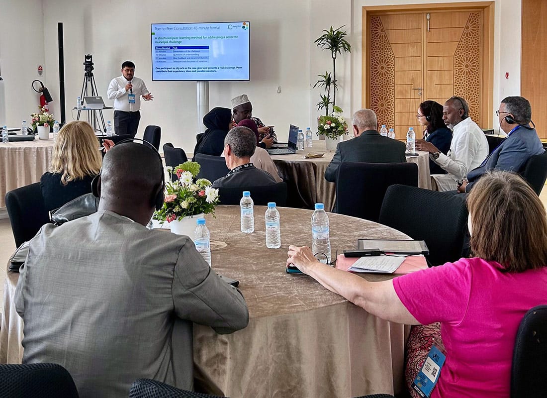
A representative of the Municipality of Pékine (Senegal) presented a real implementation challenge: complex procurement procedures, lengthy administrative processes and staff turnover were delaying infrastructure projects and slowing down municipal service delivery.
Participants jointly analysed the challenge during a facilitated Peer-to-Peer Consultation and developed a range of practical recommendations. Proposed solutions included:
- strengthening knowledge management to preserve institutional memory;
- developing clearer procurement roadmaps and process guidelines;
- improving coordination across municipal departments;
- establishing clear responsibilities and accountability mechanisms;
- promoting knowledge exchange with neighbouring municipalities;
- investing in continuous capacity development for municipal staff;
- creating databases of qualified service providers;
- introducing minimum quality standards for contractors and service providers; and
- assessing the political and institutional context at an early stage to identify opportunities for implementation.
The discussion demonstrated that municipalities across different regions often face remarkably similar implementation challenges. This is precisely where the Connective Cities approach creates value: structured municipal exchange enables practitioners to jointly develop practical solutions that can be adapted to their respective local contexts.
The Lab also illustrated how international municipal exchange can move beyond traditional good practice presentations. By openly discussing implementation challenges and working together to identify solutions, peer learning becomes a practical instrument for strengthening local public service delivery.
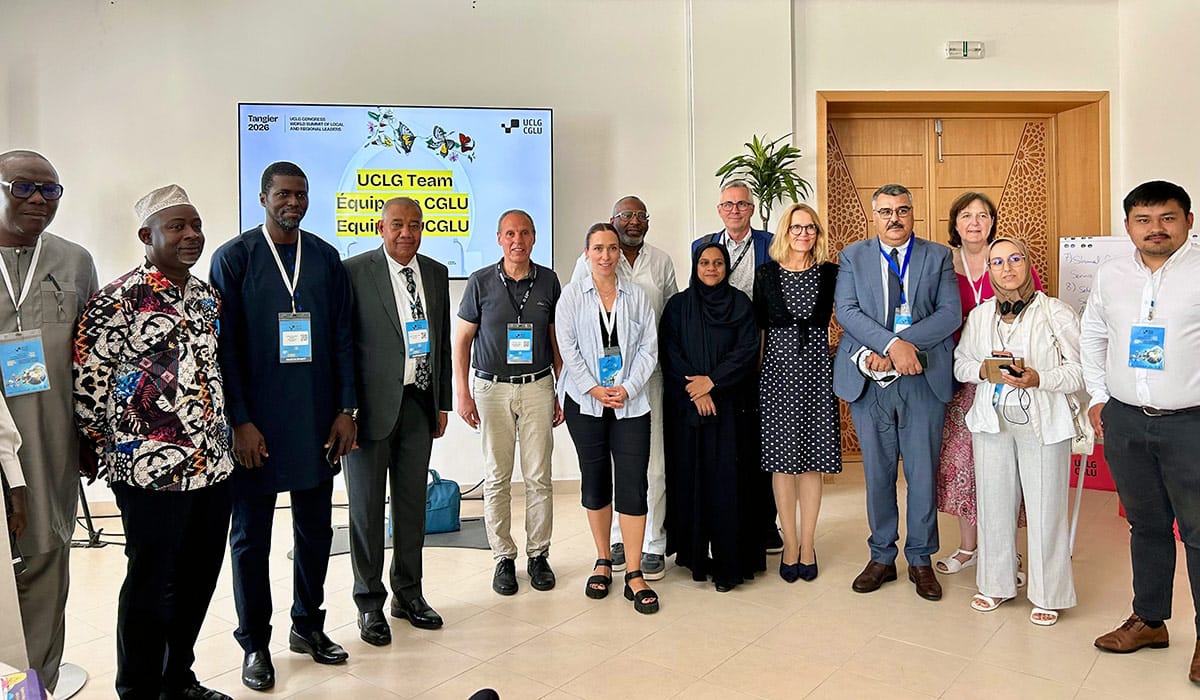
The Connective Cities team and participants in the Lab | Photo: Connective Cities
See also: Highlights of the UCLG World Congress
Insight Session Urban Tiny Forests in drought-affected Regions

On July 8th, 2026, Connective Cities hold an online Insight Session to explore ways, by which urban forests can be cultivated under difficult climate conditions. Attempts to do so are notoriously difficult in dry regions with high temperatures and low precipitation, where the usage of scarce water resources has to be distributed between (urban) populations, local businesses, agriculture and industry. Planting and watering urban trees is regularly considered secondary under such circumstances, leading to unsuccessful attempts of urban afforestation due to a lack of financial support and maintenance work. The Insight Session was joined by 34 participants from 13 countries, representing a broad range of municipalities from Africa and the Middle East.
Over the past decades, the Miyawaki-method of planting tiny forests has become an outstanding success story around the globe. In this technique developed by Japanese botanist Akira Miyawaki, a small dense forest is made from native trees and plants. The specifically dense way of planting a miscellany of indigenous plants accelerate the growth of flora and fauna, so that after around five years, micro forests may already be entirely self-sustaining. The forests improve air quality, reduce heat and bring back lost biodiversity, thereby stabilizing ecosystems and countering the environmental degradation as a result of the climate crisis. A videographic overview of the Miyawaki-Method can be found here.
Stefan Scharfe, speaking on behalf of Miya-Forest, a forest-planting/educating/researching NGO based in Eberswalde, Germany explained the success of the Miyawaki method through the instance, that planting trees is usually broadly accepted among a range of actors such as urban populations, housing providers and local administrations. However, the participatory approach of planting urban micro forests must be facilitated through a small group of core actors who take ownership of the project. Especially a thorough soil study can significantly increase the chances of the micro forests to become self-sustainable after an initial, intense phase of watering and caring.
Coming from the highly urbanized and biodiversically degraded context of Amman, Jordan’s Capital, Deema Assaf from the ecological research studio TAYYŪN joined the Insight Session as a second speaker, providing the participants with valuable hands-on insights from the MENA region. Mrs. Assaf elaborated on the tedious work with paleobotanists to collect evidence of indigenous species from the region, proven evolutionary resilient towards the local climate conditions. The seeds of these plants known to the soil form the base for a multi-layered ecosystem featuring canopy, sub-canopy, shrubs and ground cover tiers. Over the course of its growth, the micro forest attracts insects, mushrooms and birds. Also edible plants may be included, turning micro forests into sites of (urban) gardening.
In result, the Insight Session provided the participants with new inspiration for their own project development within the scope of the currently running Connective Cities learning processes on ‘Nature at the Heart of Municipal Resilience’ and ‘Green Corridors in the City and its Surroundings’. The potential of the Miyawaki Method to produce fast and self-reinforcing benefits through various ecosystem services and according to the local circumstances makes urban micro forests a tangible and fitting intervention in the current situation of intensifying climate crisis. However, forestry-related preparation – i.e. soil data and seedlings –, as well as institutional backing, secured funding and maintenance of the planting project are key elements for micro forests to thrive.
Connective Cities provides the network for future engagement on the topic and looks forward to share expertise among urban practitioners
NEWSLETTER – ISSUE NO. 95, June 2026

|


Connective Cities at the World Urban Forum 13 in Baku

At the 13th World Urban Forum in Baku, the German Association of Cities and Connective Cities hosted an interactive Academy Session on “AI-supported Visualisation for Affordable Housing and Informal Settlement Upgrading”. The session explored how AI-supported visual tools can help municipalities discuss challenges related to affordable housing, neighbourhood development and informal settlement upgrading in a more concrete and accessible way.
The session built on the work of the Connective Cities Working Group on Sustainable and Affordable Housing. It was deliberately designed not as a technology demonstration, but as a practice-oriented municipal learning format based on real municipal cases. The aim was to explore how visualisation can make complex planning questions more understandable and open new spaces for dialogue between municipalities, technical departments, decision-makers and local stakeholders.
The process started from real images provided from municipal contexts. With the support of CoPlan AI, these images were translated into possible development scenarios. The AI-generated visuals were not intended as final plans. Instead, they served as discussion inputs. They allowed participants to discuss housing quality, density, public space, greenery, climate adaptation, mobility, social infrastructure and possible implementation steps in a more tangible way.
A central added value of the format was the joint work around the images. The visualisations made abstract planning questions visible and enabled a creative, yet critical discussion: What future images are being created? Which assumptions lie behind them? Which opportunities and risks become visible? Which social, spatial, environmental, institutional and financial conditions would need to be assessed before an image can become a realistic planning step?
The session was moderated by Prof. Hilmar von Lojewski, German Association of Cities. Jelena Karamatijevic, Connective Cities / GIZ, provided the conceptual framing and introduced the Connective Cities perspective on municipal practice and peer learning. CoPlan AI, represented by Damiano Cerrone and Sampo Ruoppila, supported the participatory AI-based visualisation process.
Municipal case contributions and reflections came from Nairobi, Huye, Mariental, Hebron, Berlin and the Urban Development Fund in Egypt. Contributors included Godfrey Ngugi, Richard Ndicunguye, Sunday Haimbodi, Husam Shweiki, Lars Loebner and Dr. Marwa Ahmed. They reflected on the visual scenarios from the perspective of local planning realities, implementation constraints and possible next steps.
From Berlin, Lars Loebner from the Senate Department for Urban Development, Building and Housing contributed an important perspective on the role of images in public debates on housing and neighbourhood development. Visual representations can strongly influence how new housing is perceived. Used responsibly, they can help communicate not only abstract plans, but also positive and realistic images of liveable, socially mixed and green neighbourhoods.
A methodological input was provided by Ruvi Y. Suárez Subirana, GIZ / ProUrbano, Santa Cruz, Bolivia. Under the title “From AI Visualisation to Scenario Assessment”, she showed how AI-supported visualisation can be linked to scenario thinking and impact reflection. Her contribution complemented the discussion by underlining that AI images are not plans. Their value emerges when they are used to reflect jointly on impacts, trade-offs and possible implementation pathways.
The discussion showed that AI-supported visualisation can be a useful tool for making planning options more accessible and supporting joint learning. At the same time, participants underlined that visualisations must be used responsibly. They can create expectations and therefore cannot replace planning, participation, feasibility assessments, cost estimation or political decision-making.
From a Connective Cities perspective, the Academy Session provides an important starting point for a deeper exchange on affordable housing, informal settlement upgrading and implementation-oriented municipal project ideas. The added value lies not in the technology itself, but in its potential to strengthen municipal learning processes and help translate visualisation and mapping into realistic, inclusive and financeable urban development pathways.
Visual documentation: Current state / after AI-assisted visualisation
The following visualisations were developed as discussion inputs during the WUF13 Academy Session. They use real municipal images as starting points and AI-generated scenarios to support dialogue on affordable housing, informal settlement upgrading, public space, climate resilience and implementation pathways. The images are not final plans.
Source: Connective Cities, generiert mit CoPlan AI.
Ruanda, Huye — suburban affordable housing area
From serviced land to a liveable affordable housing neighbourhood with public space, shade and community facilities.

Kenia, Nairobi County — Mji wa Huruma
From an informal settlement to upgrading, safer public space and climate-sensitive housing.

Namibia, Mariental — incremental housing approach
From incremental housing conditions to a safer street environment with basic services, shade and walkability.

Palestine, Hebron — affordable housing in context
From an existing street section to a scenario with mixed-use edges, greenery and pedestrian-oriented housing.

Germany, Berlin — new neighbourhood development
From open land along a road to a dense, green and mixed-use housing scenario

Egypt, Sharqia — urban infill and affordable housing
From underused urban land to a compact housing scenario with shaded courtyards and public space.

NEWSLETTER – ISSUE NO. 93, April 2026

|


Greater Climate Protection and Quality of Life: Green Corridors in the MENA Region

On April 7, 2026, the new Connective Cities learning process on “Green Corridors in the city and its surroundings” was officially launched. The event was organised by Connective Cities in cooperation with the GIZ project Capacity Building through Urban Infrastructure Development (CBUID II) and was offered simultaneously in Arabic, French and English
The workshop was attended by around 70 representatives from eight countries: Algeria, Egypt, Germany, Jordan, Lebanon, Morocco, Palestine and Tunisia. Municipalities and partner institutions from the MENA region as well as the German city of Erlangen were represented. In addition to the official participants of the learning process, an extended circle of municipal representatives was further involved in the virtual exchange.
The kick-off served as technical and methodological introduction to the learning process. The aim was to set initial thematic priorities, to make municipal challenges visible and to create a common basis for further cooperation. At the same time, the event served to prepare the next steps in the process, in particular the in-depth phase and the planned face-to-face conference in Egypt.
AI-supported Visualization as Innovative Tool for Urban Planning
A central element of the kick-off was the joint AI visualization exercise on green corridors and green neighborhoods, implemented via the CoPlan AI platform. Based on images from urban contexts in the participating cities, spatial development future scenarios for climate-resilient, greener and more usable urban spaces were developed.
Around 550 images were produced as part of the exercise. The visualisation served not only to illustrate spatial changes, but also as a methodological tool to stimulate discussion about the feasibility of green corridors. In this sense, the exercise proved to be a suitable introduction for bringing together perspectives from administration, planning and local government practice.


Key Workshop Findings
The kick-off showed that green corridors and green neighborhoods in the participating cities are envisioned predominantly in urban districts and less in the cities’ surroundings. The focus is accordingly not on planning in undeveloped areas, but on the gradual further development of existing urban spaces in which housing, mobility, public use and social functions are already closely intertwined.
In that sense, it also became clear that green corridors have to fulfil several functions at the same time. They contribute to climate adaptation, for example through shading, cooling, better air circulation and water absorption. But they also contribute to the upgrading of public spaces by improving the quality of life and encounters within the city. Especially in dense neighborhoods, green corridors must therefore always be considered as social spaces of mobility and connection.
Another central aspect was the importance of participation and local acceptance. Since identified spaces are usually already intensively used, the involvement of the population is an essential prerequisite for successful implementation. This applies to the usability for distinct groups such as children, families and residents as well as the question of how green measures can be integrated into the everyday urban life.
Contribution from the Urban Development Fund (UDF)
The Urban Development Fund (UDF) underlined the importance of institutional approaches for integrated and climate-resilient urban development in Egypt. The examples presented showed how strategic urban development, upgrading of existing districts, heat reduction and public space can be more closely linked. The UDF thus not only contributed concrete experience from Egyptian practice, but also an important perspective on scaling, institutional anchoring and long-term implementation capability.
Contribution of the City of Erlangen
The city of Erlangen’s contribution illustrated that green corridors must be implemented in conjunction with traffic, accessibility and conflicts over the use of urban space. In their presentation of the local project ‘From two quarters to one campus’, Erlangen representatives demonstrated how a green boulevard, tram, bicycle, pedestrian and motorised traffic, and an existing pedestrian bridge could be brought together within one coherent planning task. Thus, the contribution from Erlangen provided important impetus for an integrated planning approach to green corridors.
Example Cities and Good Practices
During the kick-off, several municipal and institutional examples were presented that are of particular relevance for the further learning process:
- Erlangen (Germany): integrated planning approach to green corridors in existing urban space, with a focus on Green Boulevard, multimodal mobility, land use and conflicts of use.
- Aswan (Egypt): Development of the Heat Action Plan for El-Sail Elgadid, including cooling stations, shaded recreation areas and specific offers for children and women.
- Port Said (Egypt): Approaches to climate-adapted urban development and the upgrading of urban spaces under the specific climatic conditions of a Mediterranean city.
- Telal Al-Fustat Park, Cairo (Egypt): large-scale greening approach in historic Cairo with positive effects on cooling, air quality and biodiversity.
- Reviving Historical Cairo (Egypt): Upgrading historic urban areas as a combination of urban renewal, public space and historical identity.
- Al-Asmarat (Egypt): Participatory upgrading of public spaces in the residential environment as an example of the linking of green and social functions in existing neighbourhoods.
Outlook

The digital kick-off has created a reliable technical basis for the next steps of the MENA learning process. It became clear that the added value of the format lies particularly in synergy effects between concrete municipal examples, institutional perspectives, inter-municipal exchange and visual methods. In the coming phases, the identified topics will be further deepened, approaches between the cities will be further developed and jointly concretized during both online and face-to-face exchanges.
Green Corridors in the city and its surroundings

Kick-off Event: 7th – 9th April 2026 (TBC) in Egypt
Local authorities in Germany, North Africa, and the Middle East face similar challenges in the face of climate change. They are called upon to translate general strategies for climate change adaptation and climate protection into concrete local measures. One option is to develop green corridors – e.g., as green walkways in city centers or as green corridors in the surrounding areas and new neighborhoods. These enable improved fresh air supply, quality of life, and more efficient water management. Green corridors can also be used for local recreation and heat protection in municipalities.
Against this backdrop, Connective Cities offers experts from local governments in Gemany, North Africa and Middle East the opportunity to develop concrete solutions for their own contexts and exchange ideas with each other as part of a one-year learning process.
Main areas of Work
The structured learning process will focus on:
- Green corridors as fresh air corridors between cities and their surrounding areas
- Green paths in cities and old city centers
- Green new and existing neighborhoods
The methodology
The learning process follows a modular approach with the following objectives:
- Supporting participating municipalities in developing solutions through peer learning and tailored technical advice to promote green corridor solutions.
- Developing the participants’ skills so that they are better able to implement organizational changes and improve procedures and methods in their own municipalities.
- Supporting participating municipalities in their methodological approach and the development of financially viable solutions.
As part of the learning process, best practices for green corridors and climate-friendly urban planning will be presented. Participating municipalities will engage in peer learning with others to develop concrete solutions for their individual contexts. These solutions can bring about organizational changes to improve procedures, methods, and data availability, as well as the concrete implementation of pilot measures.
Using a co-creative approach, participants will be involved in a structured creative problem-solving process. This includes
- observing and understanding current municipal practices to identify challenges and gaps,
- brainstorming and developing concrete solutions, and
- testing the solutions with a group of stakeholders, including citizens and experts, to obtain feedback.
Duration
The learning process will span a period of one year, beginning with a kick-off workshop in Egypt in April 2026. A total of two German and approximately 10 municipalities from the MENA region will participate in the learning process.
Participation and contact
We are looking for experts from local governments in Gemany, North Africa and Middle East (district offices, city administrations, municipal companies, etc.) who can contribute a project or idea for a solution for green corridors to the learning process. Ideally, two experts from one municipality will apply and be able to anchor the change process in the administration in the long term. The participation costs (accommodation and board) are covered. The conference language is English and French.
If you are interested in the learning process, please apply by February 20, 2026, via this link: Learning process MENA Green Corridors 2026/2027 | Connective Cities Network stating your municipality, position, and the project/challenge in the area of green corridors.
If you have any questions, please contact jelena.karamatijevic@giz.de
Further information about: Connective Cities’ learning processes
Reuse Instead of Demolition: 2nd Hands on Public Buildings

Author: Dr. Susanne Reiff
Publisher: Connective Cities
For over a year, more than 30 experts from six countries worked as part of Connective Cities‘ learning process ‘2nd Hands on Public Buildings. Repurposing Modernist Public Buildings from the 1960s and 1970s ’ on solutions for aging public buildings from the 1960s and 1970s. How can they be sustainably reused or repurposed instead of being demolished? At four events and two working meetings between September 2024 and September 2025, they learned about current trends in this area, deepened their knowledge, heard details about possible solutions from external experts, and inspired each other with their respective experiences, approaches, and ideas.
But the participants didn‘t just exchange ideas, they also took action. They further developed the project ideas they presented at the dialogue event in Berlin in September 2024 or, in some cases, implemented them directly, taking up suggestions from the other participants. The innovative and very diverse projects impressively demonstrate the potential of the paradigm shift away from rapid demolition toward well-thought-out reuse and conversion.
The documentation provides insights into the key findings.
7 pages
Year of publishing: 2025
From Vision to Reality

Working Group: Sustainable & Affordable Housing – Connective Cities
Affordable and sustainable housing remains one of the most pressing challenges for cities worldwide. In the next phase of the Connective Cities Sustainable & Affordable Housing Working Group, this online workshop introduces visualisation methods as a practical tool to support planning, communication, and peer learning among cities.
Building on previous working group exchanges, the session integrates principles of the New European Bauhaus and explores how AI-based visualisation can help cities translate strategic housing goals into tangible spatial concepts.


The workshop combines hands-on visualisation with a mini peer-learning format, allowing participating cities to reflect on concrete cases related to building rehabilitation, public spaces, infill development, and neighbourhood upgrading.
Objectives
- Introduce AI-supported visualisation approaches for affordable and sustainable housing
- Apply NEB principles (sustainability, inclusion, aesthetics) to real city cases
- Strengthen peer consultation and collective learning among Connective Cities alumni
- Bridge the gap between visual concepts and implementation planning
Format
- Short expert inputs
- Live AI-based visualisation session using selected city cases
- City-led peer consultation with feedback from peers, experts, and the Connective Cities team


Practical information
- Date: 22 January 2026
- Time: 10:00–13:00 CET
- Location: Online (Connective Cities Platform)
- Language: English
- Participation: Free of charge, register here
The workshop is open to the public. Active participation in the AI-based visualisation (including uploading own photos) is reserved for members of the Connective Cities Sustainable & Low-Cost Housing Alumni Group.
In case of questions, please contact:
Moses Munuve – moses.munuve@giz.de or Jelena Karamatijevic – jelena.karamatijevic@giz.de